


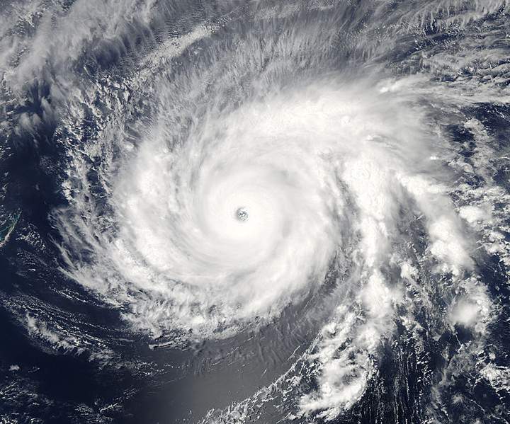
TORONTO — A powerful super typhoon has formed in the North Pacific Ocean and is making its way toward the Philippine islands.

Super Typhoon Maysak formed on March 27 as a tropical depression. It gained strength a few days later before reaching Category 5 status on the Saffir-Simpson scale.
The Federated States of Micronesia has been hit by the storm; in Chuuk, damage was reported on Monday with many homes destroyed. Many residents were without power.
Several islands in the region, including Yap, Fais and Ulithi, are under typhoon warnings.
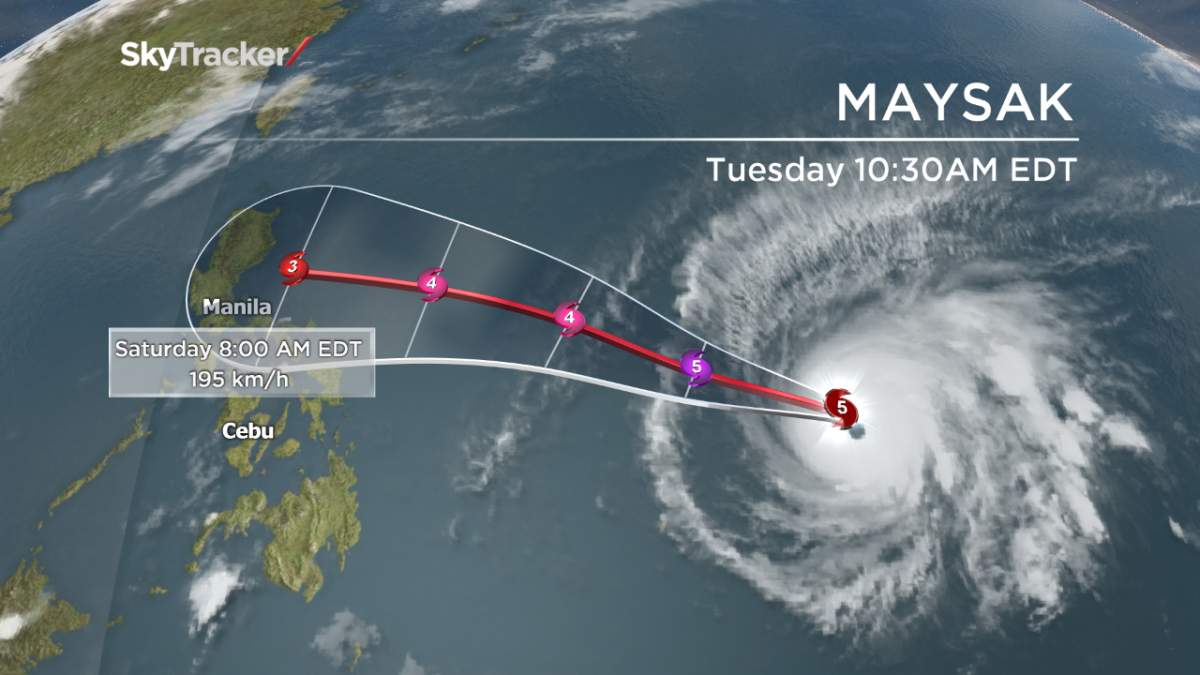
Maysak’s maximum sustained winds were close to 260 km/h as of Tuesday morning, but the hurricane-force winds extend 74 km from its centre. The storm is moving west-northwestward at around 22 km/h.
Though Maysak will likely weaken, it is expected to make landfall in the Philippines on Saturday.
“Its official track has it straight toward Luzon,” Derek Williams of the U.S. National Weather Service said. Williams said the storm is expected to weaken significantly when it gets to the Philippine Sea, but is still expected to cause widespread damage there such as flooding.
Though the storm may weaken when it travels away from Micronesia, it is an imminent threat to low-lying islands in Yap State now.
- Record slow hurricane season, but Maritimers warned to stay vigilant about extreme weather
- Tornado confirmed in Winnipeg neighbourhood, another west of the city
- ‘A lot of work ahead’: Storm-ravaged Saskatchewan cities continue cleanup
- ‘Warzone’: Storm rips through Winnipeg leaves thousands without power


It is expected to pass just north of Fais this afternoon. The eye is about 100 km away.

Get breaking National news
“The weather conditions are deteriorating rapidly. Typhoon conditions on Fais is imminent,” said Williams. Ulithi is an atoll about 3 metres above sea level, and Fais is 9 metres above sea level. “The entire island could be covered in water from storm surge.” The storm is expected to hit Ulithi tonight.
–with files from The Associated Press


Comments
Want to discuss? Please read our Commenting Policy first.