


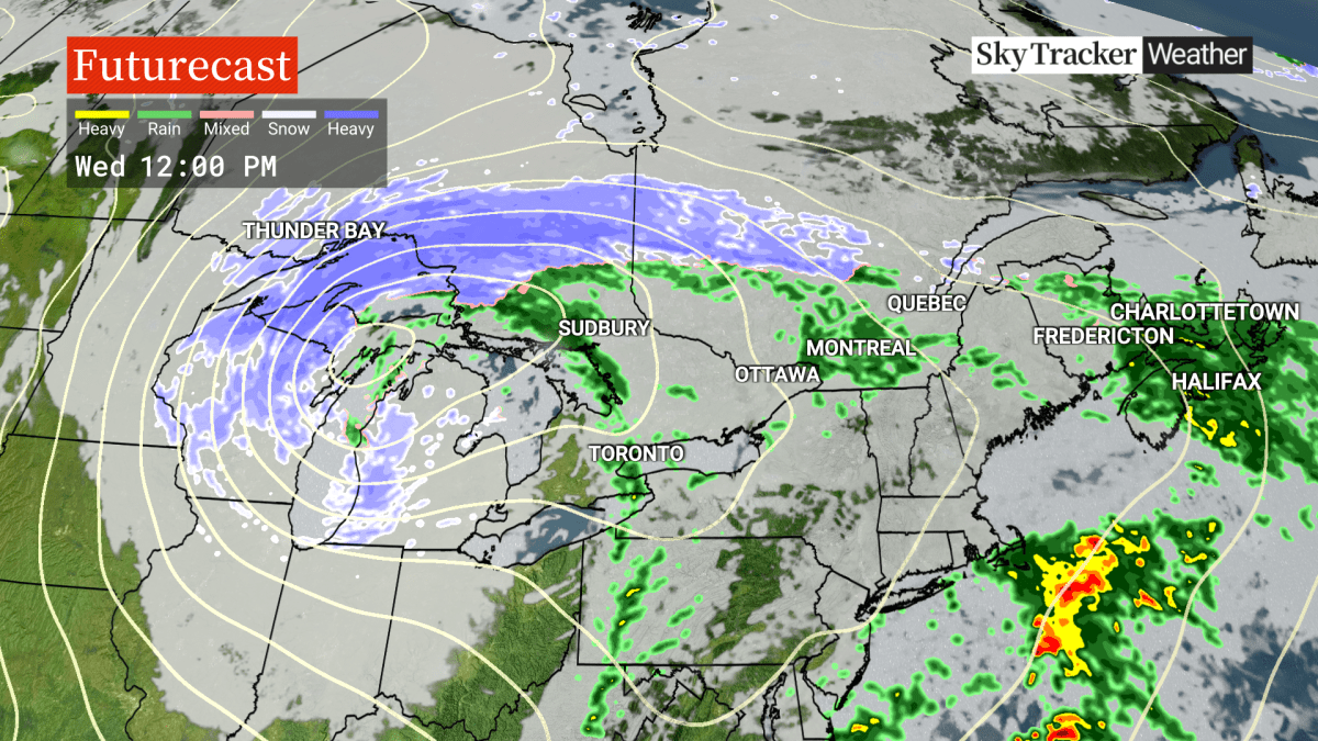
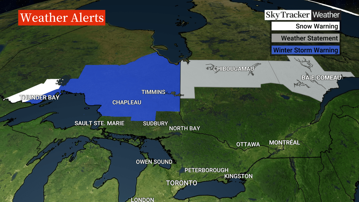
A winter storm brewing north of Sudbury and North Bay in Ontario threatens to blow over central Quebec this week.

“This system will impact a vast area of northern Ontario and central Quebec,” said Global News meteorologist Ross Hull. “These areas can expect significant snow beginning Tuesday night and lasting into Friday – with strong winds accompanying the system.”
Winter storm warnings from Environment Canada predict 70 km/h winds and blowing snow across northeastern and northwestern Ontario. Special weather statements are already in effect in northern central Quebec.
“Visibility will be reduced because of the heavy snow coupled with strong wind,” Hull added.
- ‘Godzilla’ El Nino set to bring warmer, drier temperatures to Canada
- Heat waves linked to 50K deaths in Europe this summer, report says
- High winds from Subtropical Storm Josephine nix N.S.-P.E.I. ferry crossings
- Subtropical storm bringing rain and wind to parts of Atlantic Canada, diverts cruise ship


“No significant accumulations (are) expected for the Toronto to Montreal corridor, however with the modified Arctic air moving in, there could be some periods with heavy bursts of snow on Thursday and Friday,” he added. “The cold air regime looks stick around into at least the start of December.”
Southern Ontario and southern Quebec will be spared, facing double-digit temperatures and showers, on the warm side of the weather system.

Get breaking National news
However, the storm will move east Wednesday night, with Hull saying a temperature drop Wednesday will bring with it the potential for a significant, multi-day lake-effect snow event for the snowbelts southeast of Lake Huron and Georgian Bay.
Non-essential travel should be postponed until conditions improve, Environment Canada said.


Comments
Want to discuss? Please read our Commenting Policy first.